


WILLOUGHBY HILLS CITY HH Voting District, Lake County, Ohio
About
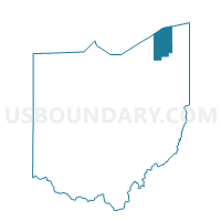
Outline

Summary
| Unique Area Identifier | 648283 |
| Name | WILLOUGHBY HILLS CITY HH Voting District |
| County | Lake County |
| State | Ohio |
| Area (square miles) | 0.26 |
| Land Area (square miles) | 0.26 |
| Water Area (square miles) | 0.00 |
| % of Land Area | 100.00 |
| % of Water Area | 0.00 |
| Latitude of the Internal Point | 41.58589150 |
| Longtitude of the Internal Point | -81.48084180 |
Maps


Graphs
Select a template below for downloading or customizing gragh for WILLOUGHBY HILLS CITY HH Voting District, Lake County, Ohio


Neighbors
Neighoring Voting District (by Name) Neighboring Voting District on the Map
- Voting District EUCLID-03- B, Cuyahoga County, OH
- Voting District RICHMOND HEIGHTS-01- B, Cuyahoga County, OH
- Voting District RICHMOND HEIGHTS-01- C, Cuyahoga County, OH
- WICKLIFFE CITY 1B Voting District, Lake County, OH
- WICKLIFFE CITY 2B Voting District, Lake County, OH
- WILLOUGHBY HILLS CITY CC Voting District, Lake County, OH
- WILLOUGHBY HILLS CITY DD Voting District, Lake County, OH
Top 10 Neighboring County Subdivision (by Population) Neighboring County Subdivision on the Map
- Euclid city, Cuyahoga County, OH (48,920)
- Wickliffe city, Lake County, OH (12,750)
- Richmond Heights city, Cuyahoga County, OH (10,546)
- Willoughby Hills city, Lake County, OH (9,485)
Top 10 Neighboring Place (by Population) Neighboring Place on the Map
- Euclid city, OH (48,920)
- Wickliffe city, OH (12,750)
- Richmond Heights city, OH (10,546)
- Willoughby Hills city, OH (9,485)
Top 10 Neighboring Unified School District (by Population) Neighboring Unified School District on the Map
- Willoughby-Eastlake City School District, OH (65,407)
- Euclid City School District, OH (48,923)
- Wickliffe City School District, OH (12,750)
- Richmond Heights Local School District, OH (9,884)
Top 10 Neighboring State Legislative District Lower Chamber (by Population) Neighboring State Legislative District Lower Chamber on the Map
Top 10 Neighboring State Legislative District Upper Chamber (by Population) Neighboring State Legislative District Upper Chamber on the Map
Top 10 Neighboring 111th Congressional District (by Population) Neighboring 111th Congressional District on the Map
Top 10 Neighboring Census Tract (by Population) Neighboring Census Tract on the Map
- Census Tract 2010, Lake County, OH (5,056)
- Census Tract 2008, Lake County, OH (3,700)
- Census Tract 1962, Cuyahoga County, OH (3,278)
- Census Tract 1801.04, Cuyahoga County, OH (3,010)
- Census Tract 2009, Lake County, OH (1,949)